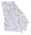
Georgia (U.S. state) counties map.png
From ENC Phillips Group Wiki

Size of this preview: 523 × 600 pixels. Other resolutions: 209 × 240 pixels | 418 × 480 pixels | 817 × 937 pixels.
Original file (817 × 937 pixels, file size: 198 KB, MIME type: image/png)
File history
Click on a date/time to view the file as it appeared at that time.
| Date/Time | Thumbnail | Dimensions | User | Comment | |
|---|---|---|---|---|---|
| current | 12:26, 11 July 2006 |  | 817 × 937 (198 KB) | PhilFree | Category:Maps of Georgia (USA) |
File usage
The following page links to this file:

